During my short trip to Brunei early this year, I was longing for a short 'walk in the woods'. I found myself in this not-so-secret playground of the locals, which is just a walk away from the main historical town center of Brunei! On a smaller scale compared to what I am used to, Tasek Lama Recreational Park and its hiking trails satiate my heart's desires!
Location of Tasek Lama Recreational Park:
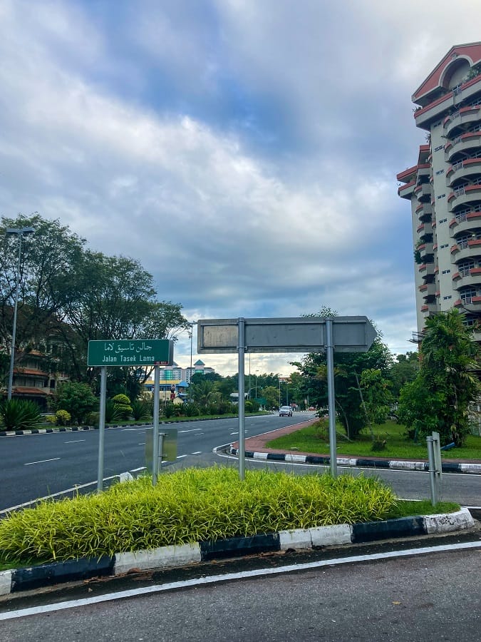
Probably the closest outdoor playground of the locals, Tasek Lama Recreational Park is within reach of Brunei's historical city center. Tucked behind residential apartments along Jalan Tasek and Jalan Kianggeh road is where Tasek Lama Recreational Park and its hiking trails are.
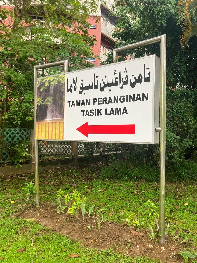
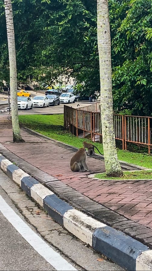
From the main road, enter the service road and continue straight for 450 meters. You'll know at the right place once you see the parking lot with monkeys 😉
Coordinates: Entrance to Tasek Lama Recreational Park
How to get there and how to get out?
Since I find the public transportation dynamics in Brunei a little tricky, and I hate waiting for the bus, I ended up walking. From BK Hostel, the crazy woman in me walked to the park for 30 minutes.
Starting at Jalan Sultan Omar Ali Saifudden, I followed the main road and turned right at Jalan Bendahara. The road then merges with Jalan Tasek and I walked until I reached the service road up to the entrance of the park.
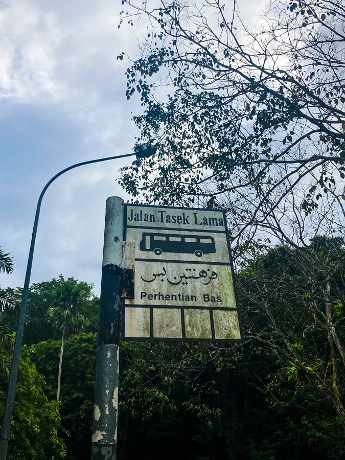
Alternatively, if walking is not your thing, there is a bus you can catch. According to Brunei Bus Routes, take Bus 36 or Bus 38 from BSB Bus Terminal and ask the driver to drop you at Tasik Lama (3rd bus stop) along the way.
Trailhead:
Similar to Hong Kong Trail trailheads, a map is found at the entrance of Tasek Lama Recreational Park. It isn't as detailed as Hong Kong's maps, but it gives you an idea of what to expect before you start.
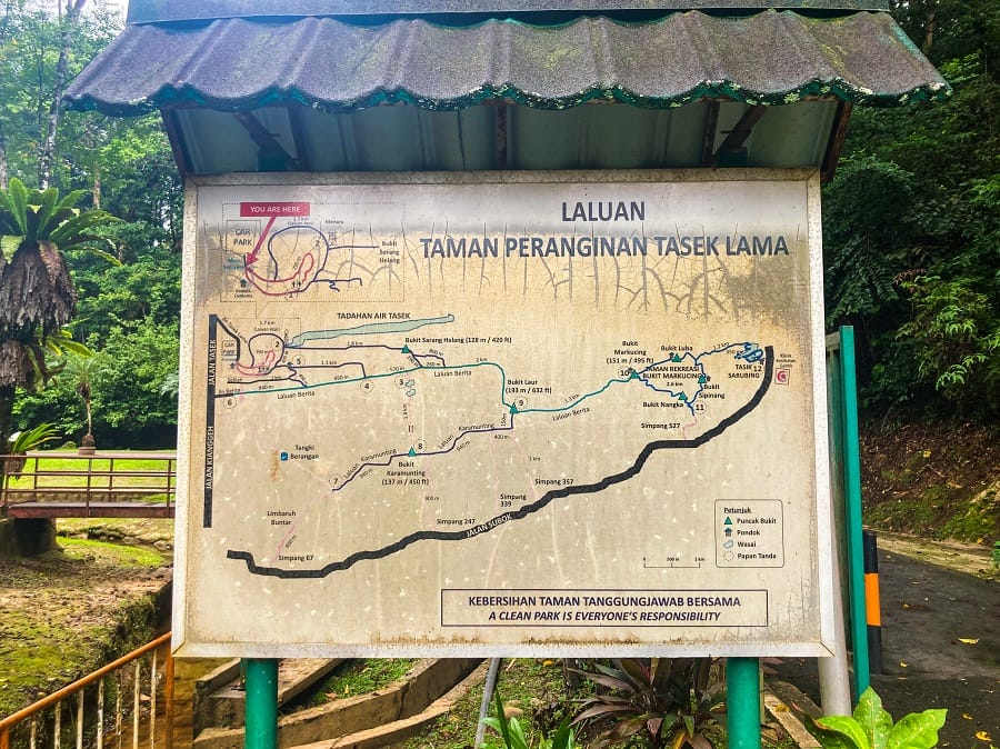
However, the essential part is too far and too small from the (MY) eye level that I had to take a photo and zoom it from my phone. From the zoomed photo, only then I understood the bigger picture from the map.

Tasek Lama Park and the short hiking trail:
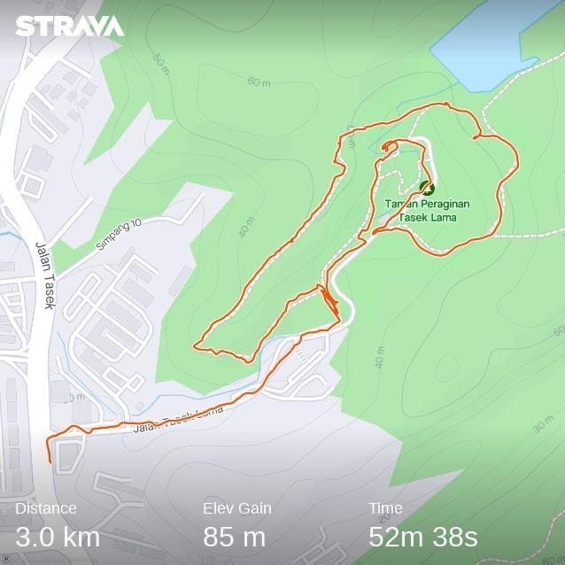
As my visit was more of an 'explore walk' and 'just casually checking', what I'd lay down below are just a few highlights of the park instead of my usual hiking guides with trail sections. These highlights are seen during my 3-km walk inside Tasek Lama Park including my walk along the not-so-obvious hiking trail found inside.
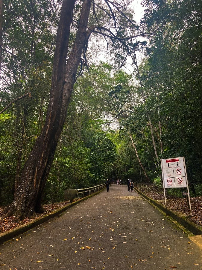
Jogging Track, Waterfalls, and Road to the Watch Tower
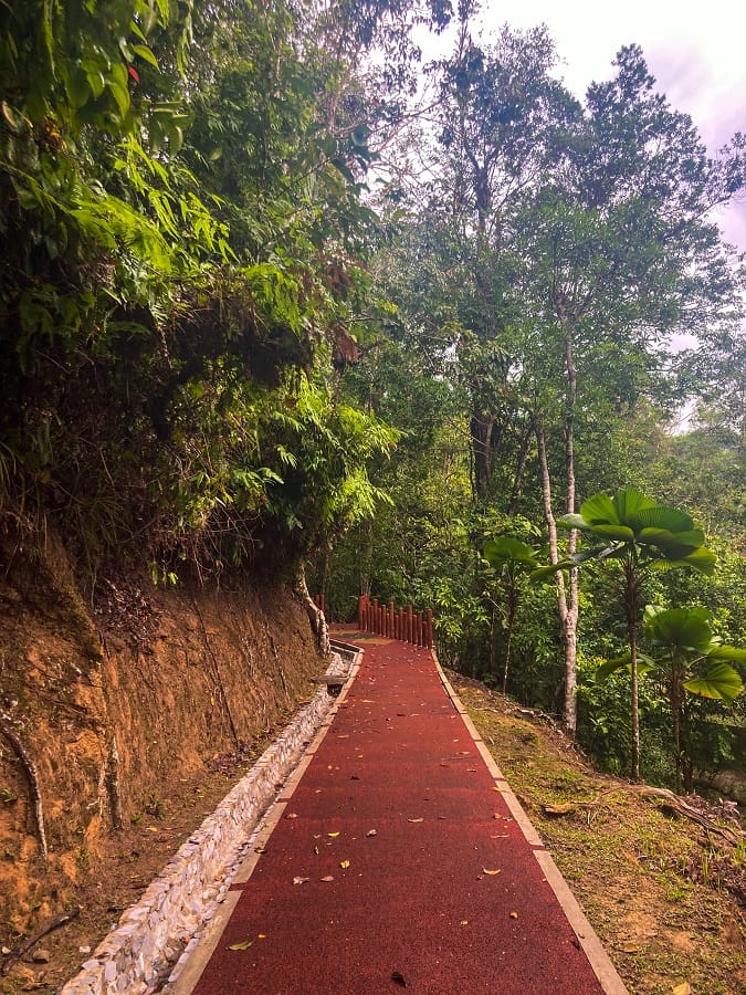
Upon entering the park, I followed the nicely red Tartan jogging track which surprised me big time (in a good way). The track led me to some wooden stairs and up and down as I go, I've seen some board signages about birds that can be found inside the park.
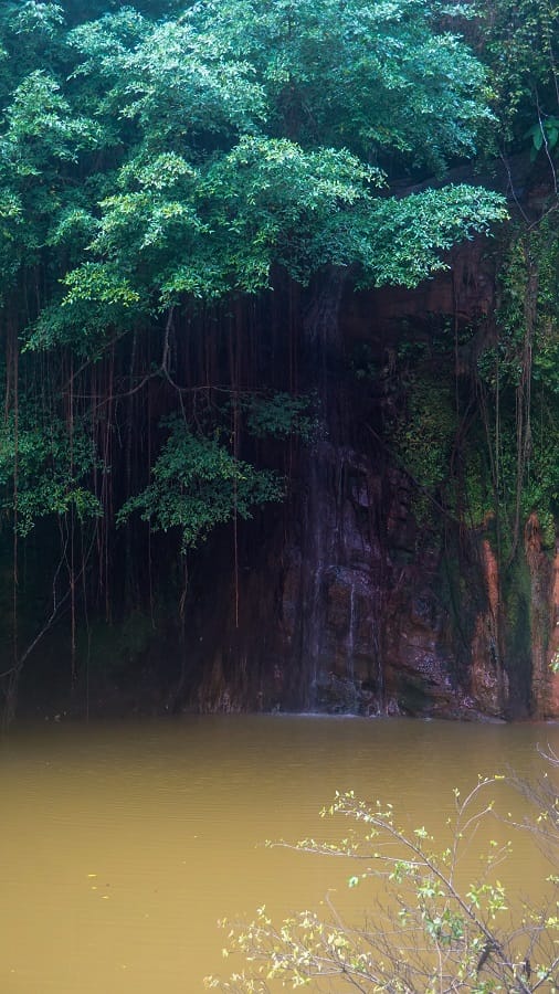
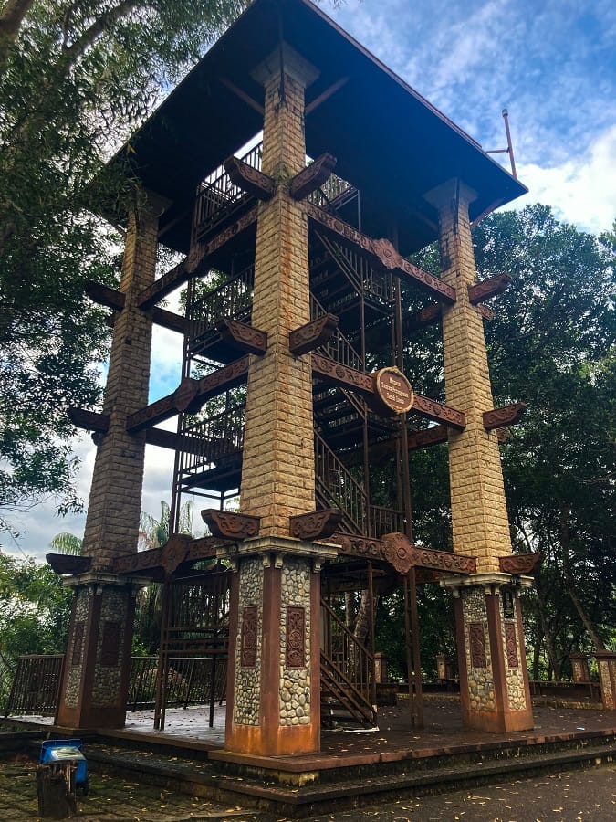
I went back to the broad paved road after spending some time at the waterfalls. There was a small fork in the paved road, and I followed the locals who were walking toward the higher route. The road ends at the watch tower but I didn't try going up instead I went straight to the reservoir in the opposite direction.
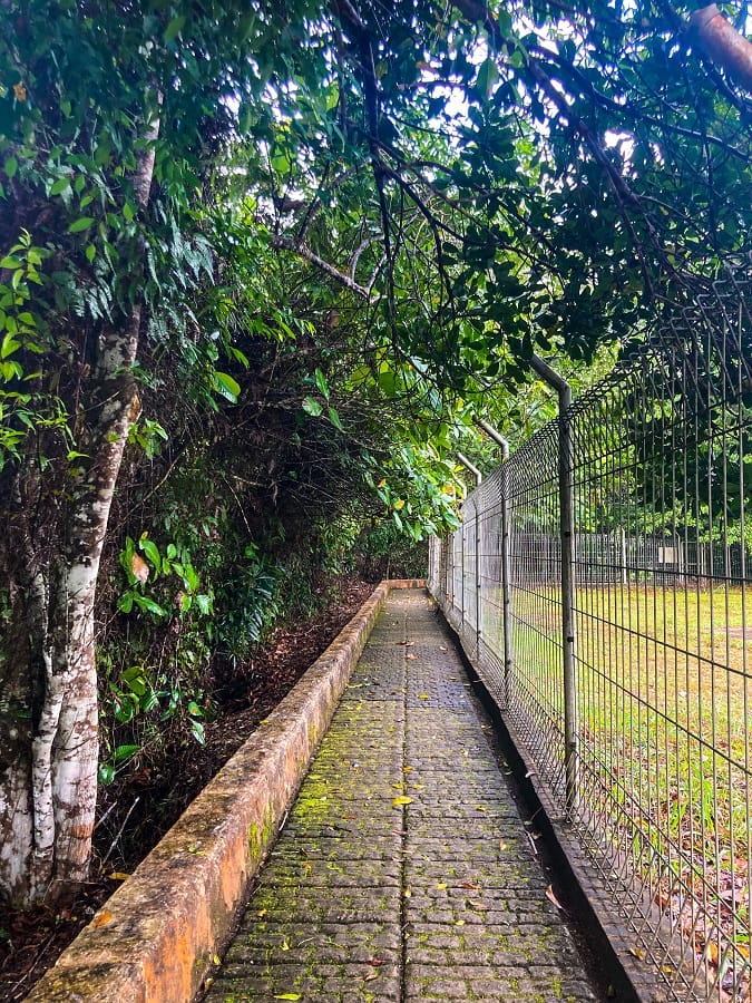
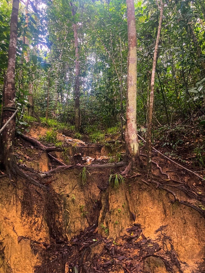
Reservoir & Lush Forest with Dirt Hiking Trail
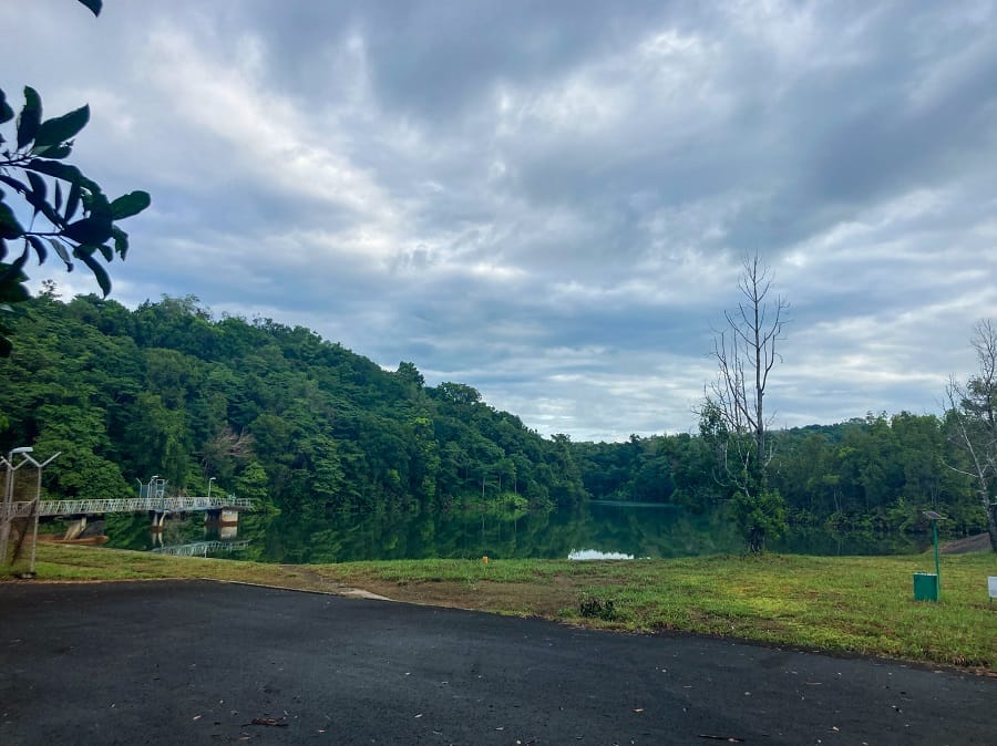
Now at the latter part and my favorite part, my walk continued after I found the hiking trail to enter the woods. From the fenced reservoir, a narrow paved road is on the left and I followed it until I took a left turn which led me finally into the lush forest.
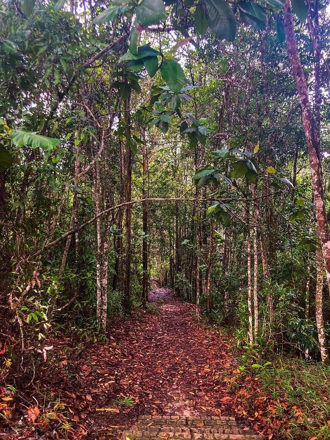
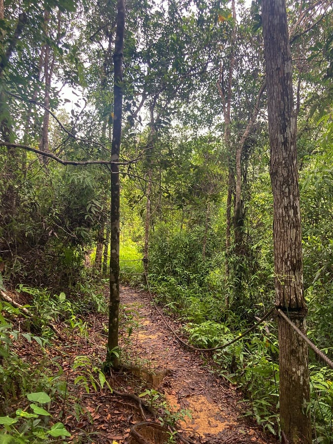
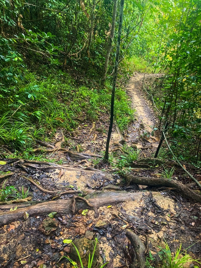
As I walked deeper into the forest, it gave me a feeling that I was far from the city which is what exactly I was looking for. I've walked on short yet rugged and muddy trails. Fallen foliage, steep paths between roots of trees with the assistance of ropes, narrow trails with lush greeneries on both sides - these are what you can expect from the trail.
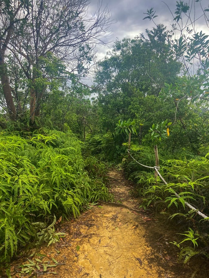
The hiking trail ended shortly, not even 2 km in distance from the reservoir, and I found myself back at the tartan jogging track. While this is super short, I've seen two more (possible) entrances of hiking trails during my walk. I don't know where it'll lead them as of the moment, but I'll come back for them. I also wanted to find the trail toward Bukit Sarang Helang.
Personal Thoughts:
We all have different adventure appetites or what I call ‘#hikeppetite’ to begin with. So, a good trail for me might not be a good trail for you. And that’s completely okay, we don’t need to agree with everyone all the time. Anyhow, here’s what I think about my nice walk in Tasek Lama Recreational Park:
Pros:
- This trail is short and easy. Despite some steep and slippery parts, the trail is child-friendly (5 years old and above).
- Proximity to the city center and it is easy to reach either by public transportation or by walking (if you don't have a car).
Cons:
- Due to the proximity of the park, it can get crowded (locals exercising and training). If you prefer a quiet place, you may have to go when everyone else is at work.
- Maps and signages should be improved. The park doesn't have any trail signs at all (where to enter, exit, current location, and emergency contact numbers). There may be people who don't know how to read basic maps or walk without a GPS, and a lack of maps and signage can throw them off in the wrong direction. Although people should start learning, seriously.
Similar to my Hidden Oasis and Wadi Shawka hikes (both in the UAE), this trail is nice but super short for my appetite. But since it's my first time in Brunei, it's not bad to just get the idea for now. I still enjoyed my morning walk in Tasek Lama Recreational Park and was happy to find the hiking trail. I'll check the trail that leads to Bukit Sarang Helang next time and make this a longer hike 😉

Whatever decision you make, always remember to prepare beforehand, stay safe, and last but not least, enjoy the outdoors! #happyhiking!
With lots of love,
PINAYHAKAWATI 💗
AND AS A GENTLE OUTDOOR ETHICS REMINDER:
LEAVE NO TRACE!