The country and the archipelago's highest mountain, climbing Mount Apo require you to do a multi-day hike regardless of the trail you choose. Navigated my way for 3-days through one of its gorgeous trails, read this if you're interested in hiking Mount Apo via the Santa Cruz Trail!
Mount Apo - Santa Cruz Trail Overview:
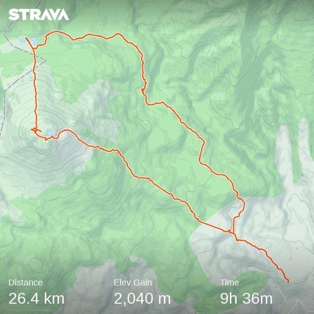
- Route: Mount Apo via Santa Cruz Circuit Trail
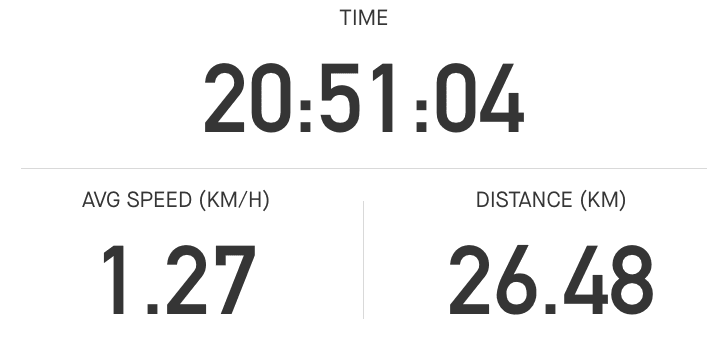
- Distance: 26.4 km in total (BUT a few km were missed, I forgot to resume the hike)
- Days Needed: 3 Days
- Actual Moving Time: 20 hours 51 minutes (Strava is drunk on that 9 hours & 36 minutes)
- Difficulty Level (own opinion): 3.5 out of 5
- Ideal time to hike this trail: September to May
NOTE: Mount Apo is temporarily closed from June to August every year due to its annual rehabilitation program.
How to get there and how to get out?
Most likely, your transportation is already included if you arranged your hike with a local operator (which is mandatory and I will discuss below). Your journey starts in Davao City and your local operator will pick you up and take you to the jump-off. After your hike, your arranged transfers will again take you back to Davao City.
Looking for a place to stay in Davao City before your hike? Check my review of The Manor Hotel!
But, there are a few exceptions to this. Your package may not include transportation. Or you could be coming from a different part of Mindanao. So always check these details with your local operator.
The trail is also a loop/circuit trail which means you will start and finish at the same trailhead, in Sitio Culan. There are no shortcuts along the trail (as far as I know). In case of emergency or you want to quit midway, you are left with only two choices - to finish the trail or backtrack.
Anyhow, from Davao City, your journey to reach the trailhead will look like this:
Davao City → Digos City OR go straight to Kapatagan → Desander Powerplant → Sitio Culan → Hike → Vice Versa
Public Transportation as an Option
In case your transportation is not included, of course, you have the option to take public transportation. The route is not complicated and the fare is economical but it will take more time and energy. From Davao City, you have to take the following to reach Kapatagan:
- 1-hour Bus Ride from Davao City to Digos City for Php 120.00 per person per way
- From Digos City, hire a Tricycle (Php 150.00 per tricycle and can fit 3 people) or take the Shuttle Bus (Php 70.00 per person) to Kapatagan

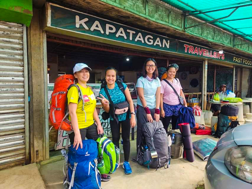
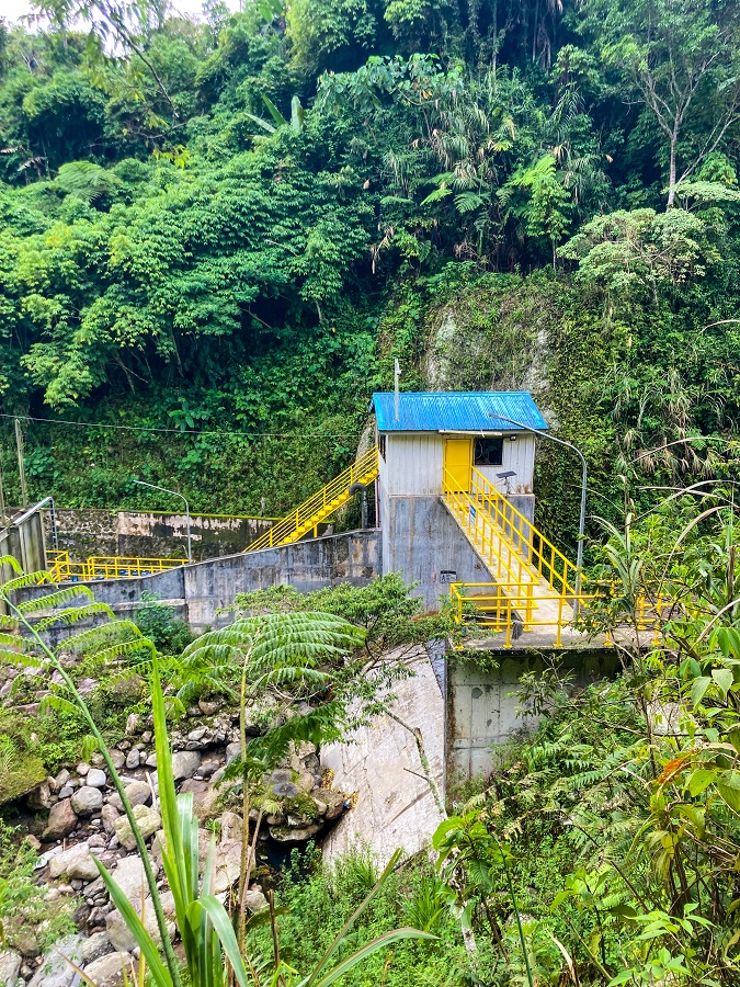
In Kapatagan, a pickup truck will take you to Desander Powerplant (most likely arranged by the local operators). Upon arriving at Desander Powerplant, you have to hike for about 15-20 minutes to reach Sitio Culan.
Trailhead of Mount Apo via Santa Cruz:
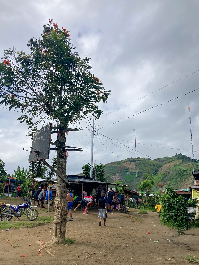
Sitio Culan is a small neighborhood located in an upper valley. It is a typical mountain village in the Philippines. A few humble homes with colorful iron sheets as roofs, a barangay office (village office), and of course a basketball court (always present!). Small retail stores called 'sari-sari stores' are also available where you can buy some essentials (snacks, drinks, etc.) although they may not have everything you need.
Jump-Off: Coordinates of Sitio Culan where you will start your hike officially*.
Hiking Trail Sections:
1) Sitio Tumpis and the Forest Line
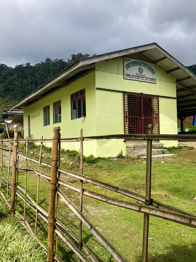
As you leave Sitio Culan behind, you will walk along the valley and enter a new neighborhood called Sitio Tumpis. Villagers' houses and their small colorful gardens, a small local church, and a few farmlands are your sights.
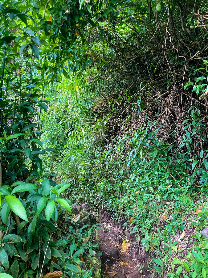
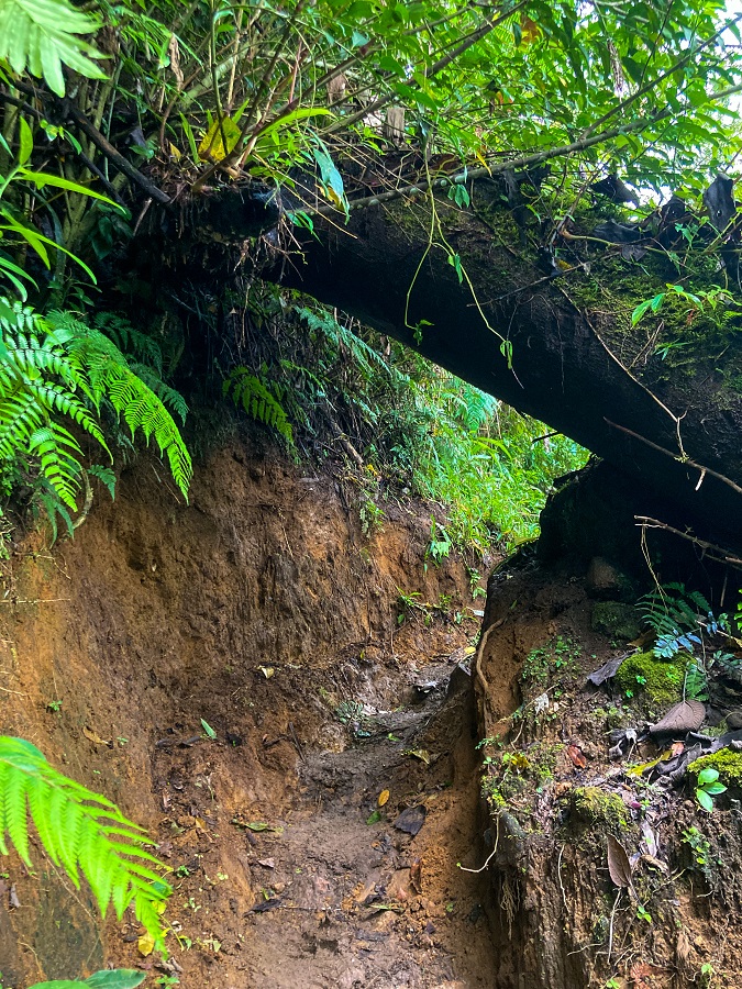
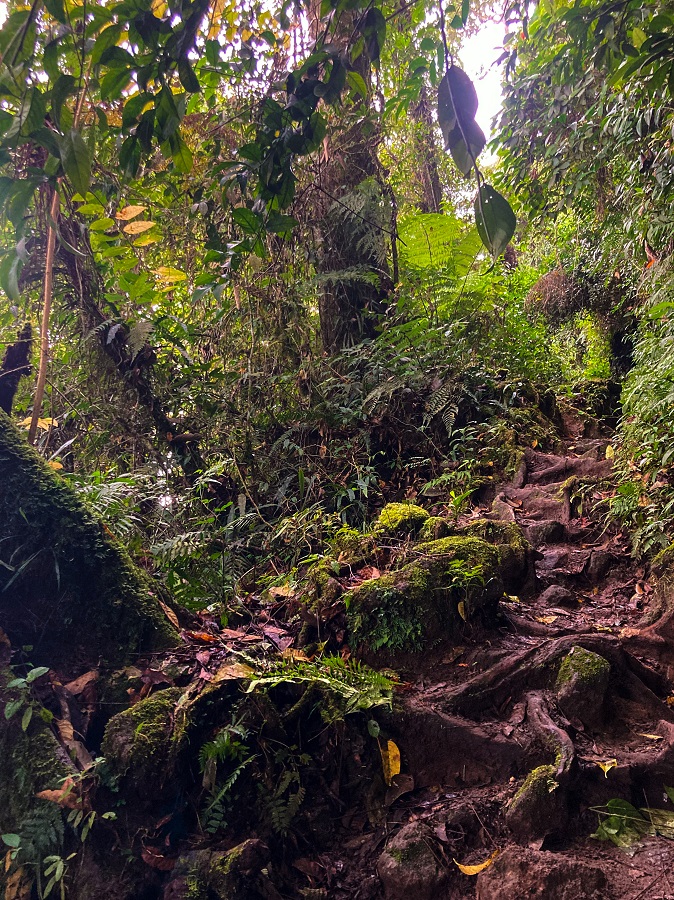
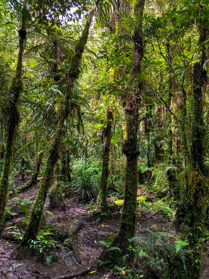
Not long after is the start of the forest line and a moderately dense forest awaits. Narrow trails, muddy tracks, trunks and branches of trees, and a sparsely mossy forest await in this section.
2) Mossy Forest to Tinikaran Camp
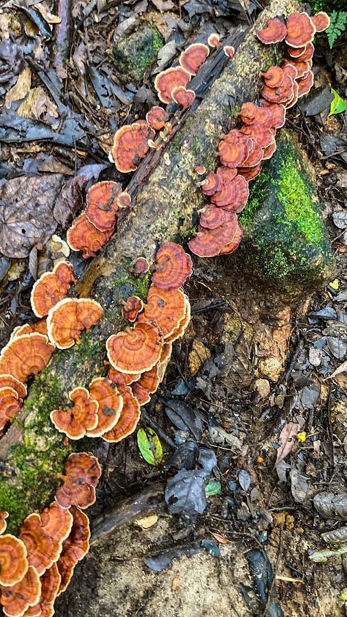
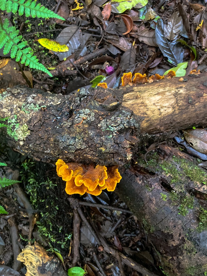
As you go deeper into the forest, you will come across some more mossy forest sections though not as abundant as the ones I saw from Mt. Pulag. There are a few stopover stations also between hills as rest stations. A good amount of variety of vegetation is seen here, with my favorites such as the orange mushrooms.
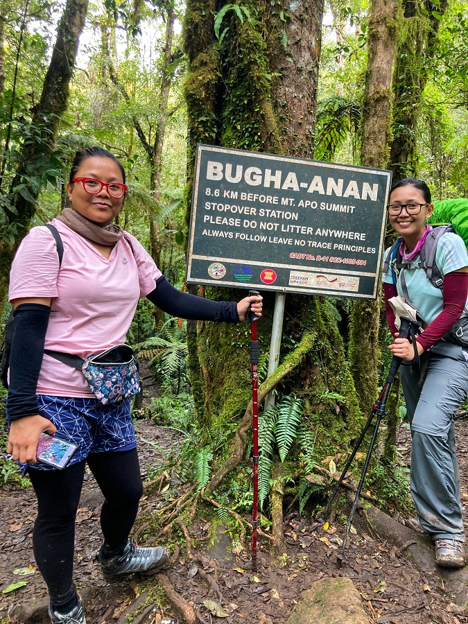
Surrounded by a damp moss smell and chirps of different birds, it's a complete sensory overload with so much beauty of its own. As much as I wanted to inhale all of it for a longer time, I noticed that the guides and the other groups had picked up their pace. Unbeknown to me, I learned that they are vying for a good spot in Tinikaran Camp hence they want to reach early.
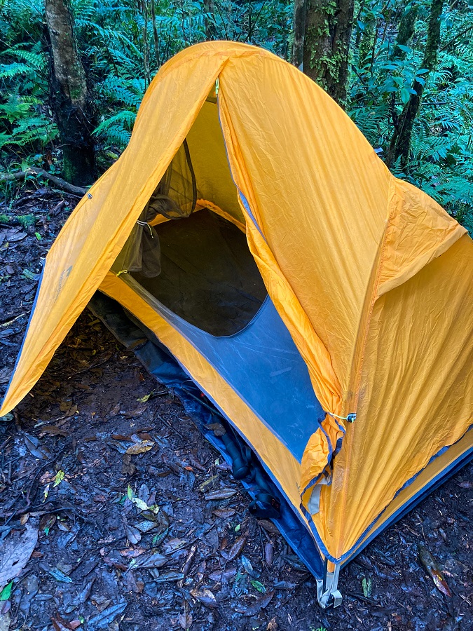
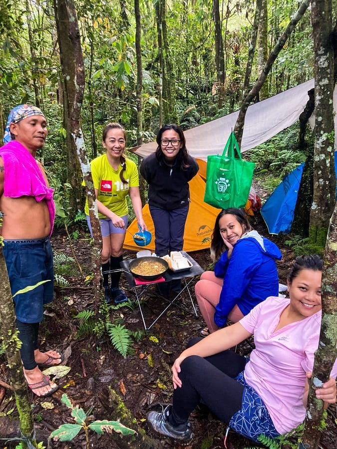
True enough, we arrived later than the other groups and found no good spot for us anymore. I didn't even get the chance to see what Tinikaran Camp looked like. I heard that there's a water source and a toilet facility at the camp and that's about it. Instead, we pitched our camp around 100 meters away from Tinikaran Camp. The good thing though is we've got a secluded area for ourselves.
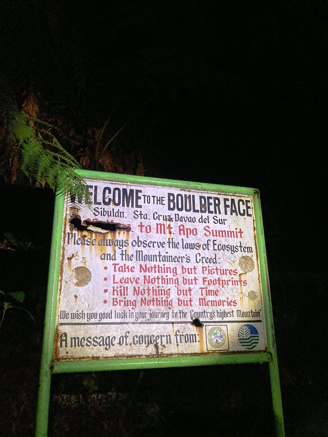
3) Steep Slopes, Boulders Face, Sulfur and its vents
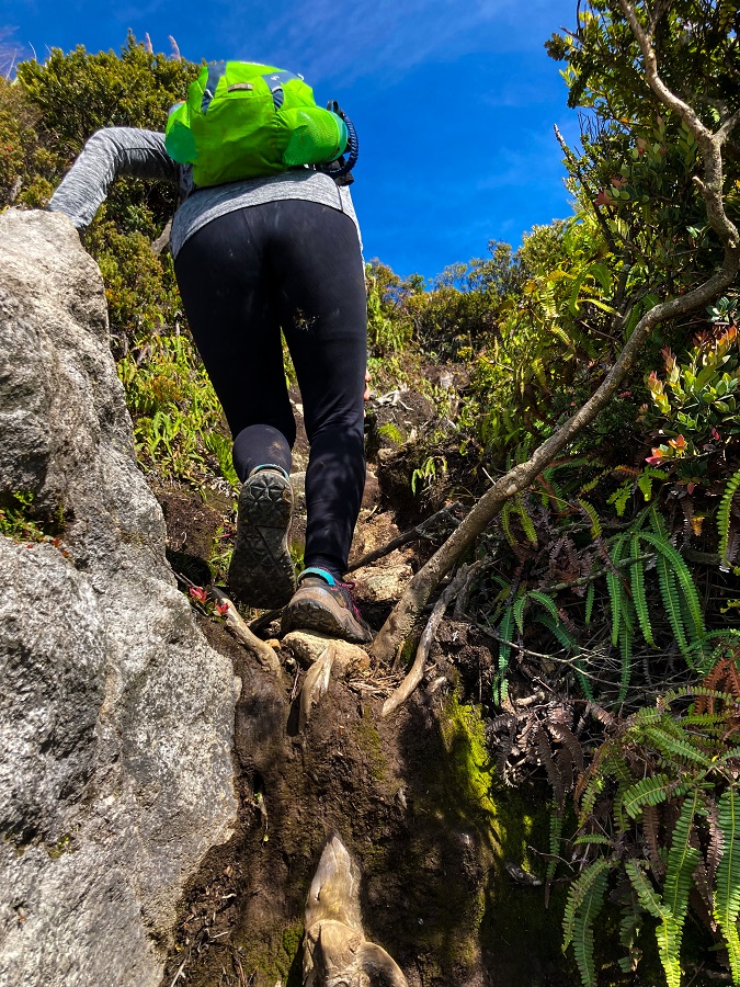
Moving forward at 2 AM, it's a walk in the remaining part of the muddy forest. Steep slopes will test you towards the end as you will have to pull yourself up by holding on to the roots and branches of trees. Add the fact that it will be a wet and foggy morning, my eyeglasses did not cooperate at all (hello moist!).
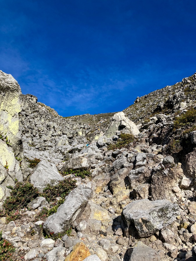
This section lasted for about an hour (at my pace) until we reached what they call the entrance to the Boulders. The entrance has a sandy portion and it's a relief to know that the muddy part is over.
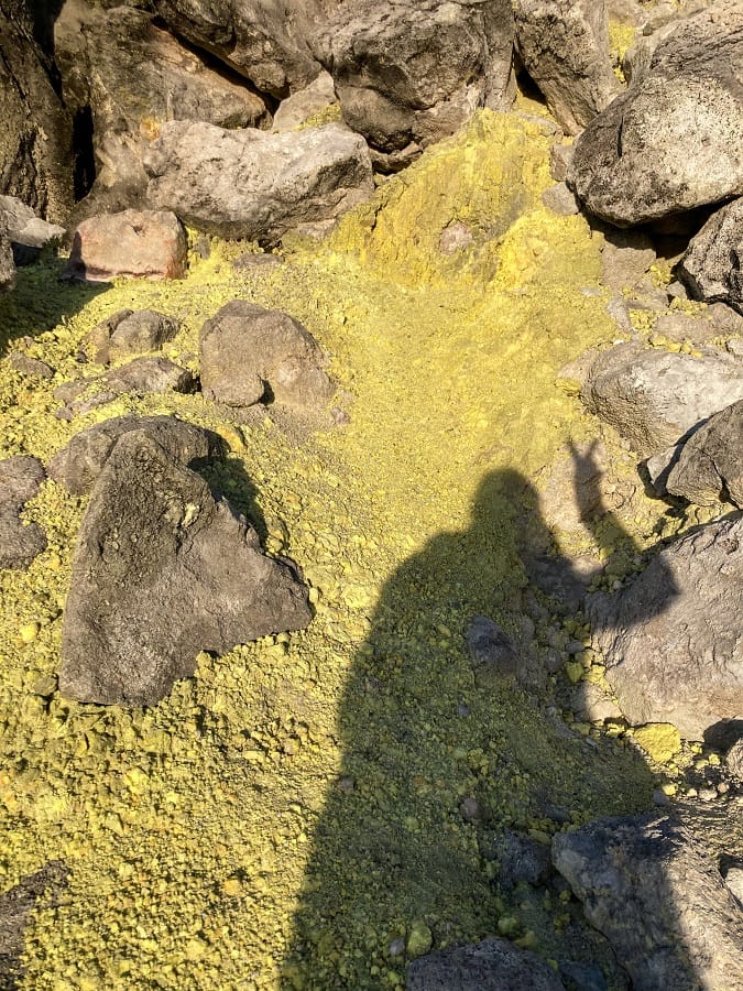
Sulfuric rocks (and the pungent smell) will welcome you next. As the guides advised, inhaling the sulfur does not have any health impact. However, we are still advised to wear a buff because of its smell (smells like rotten food).
The earlier you arrive at the Boulders, the better as you will be exposed to the sun. It was a combination of walking and scrambling and I feel comfortable tackling this part. No moving boulders were experienced thank God (like the ones I usually encountered in the UAE).
However, I struggled badly at the upper portion because the red day came at the wrong time. Like why the f*ck will it come out while I'm at the boulders! A sad day to be a girl for real!
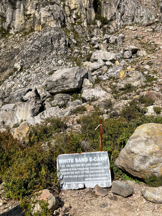
4) White Sand E-Camp & 87-degree Trail
Moving on, the White Sand E-Camp is at the top of the boulders section. It's a small area of an emergency camp at the bottom of the 87-degree section with its grainy cream-colored sand (not white). The 87-degree section comes next and while it sounds intimidating, it is relatively short but you will be scrambling most of your way up.
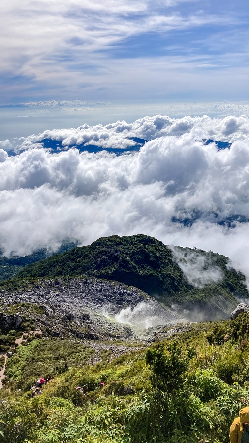
If you look behind you, you will see the sulfur vents spread out from different sides of the mountain.
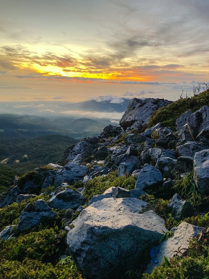
5) Mount Apo's Crater Lake & Summits (3 summits!)
Above the 87-degree section lies the mountain's crater lake surrounded by the 3 summits.
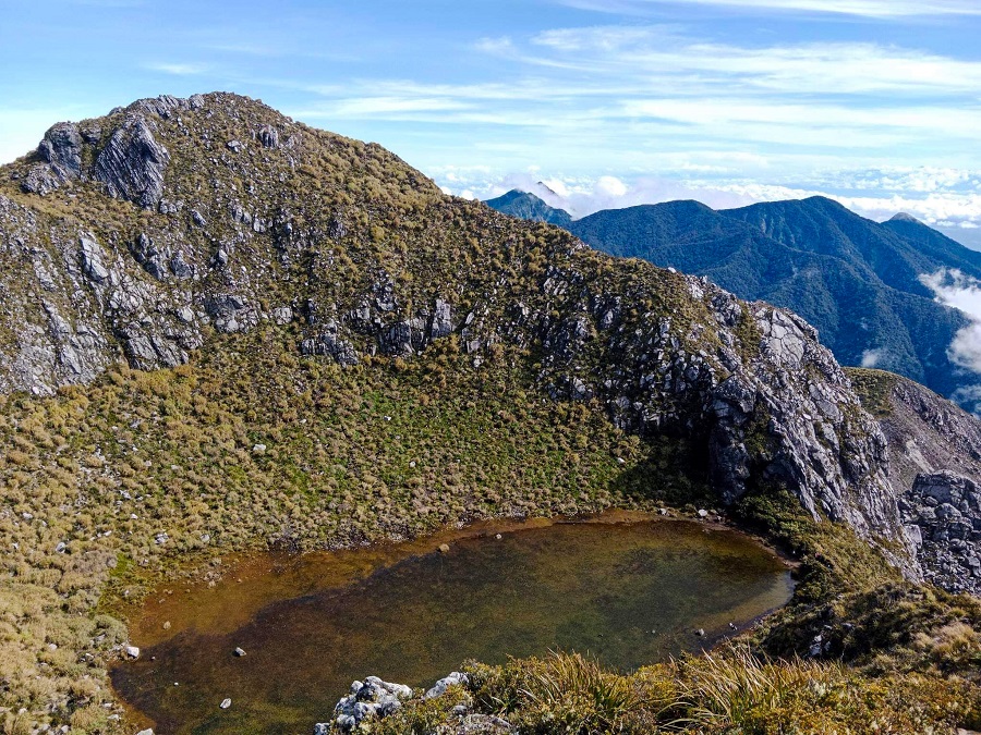
Now just a stone's throw away is the mountain's three summits. Behind the crater lake and the summits is a small ground where guides take the hikers for lunch. While the guides prepare for lunch, the hikers can reach one or all of the summits alternatively depending on their choice.

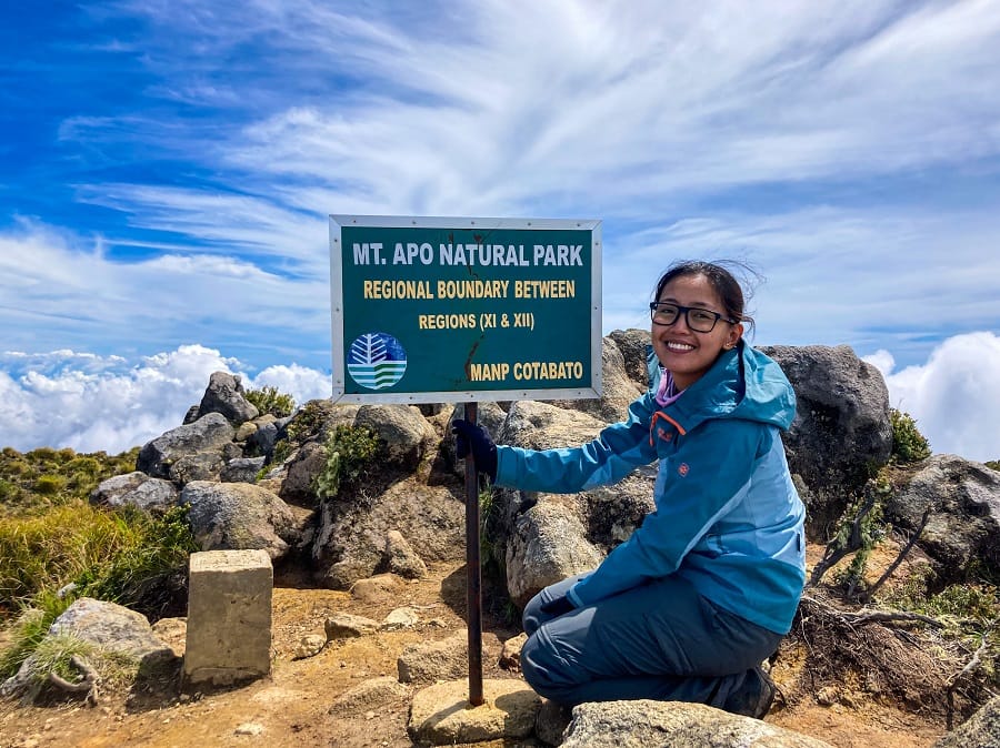
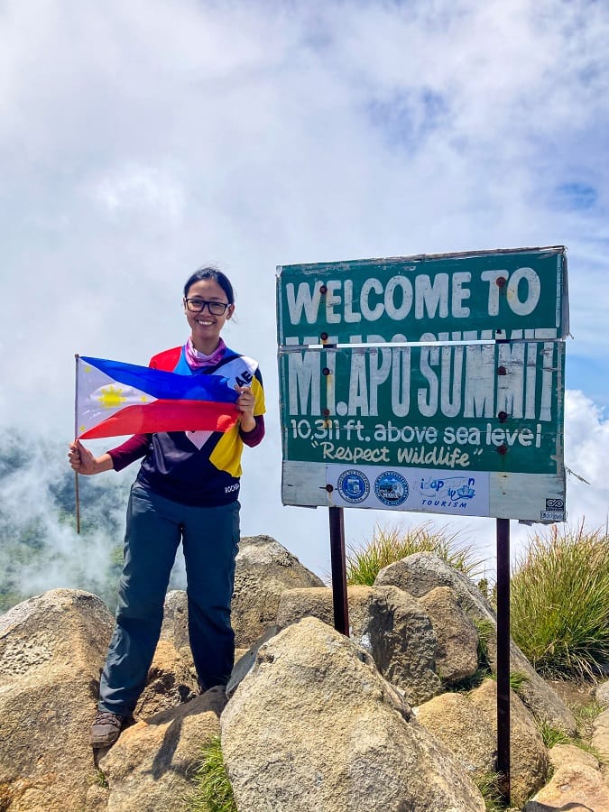
Mount Apo has three peaks namely Santa Cruz Peak, Kidapawan Peak, Mother Peak, or what they call the True Summit. The three peaks are quite a distance away from each other and you will have to go up and down each peak to move to another. The Mother Peak, the highest peak of the Philippines sits at an elevation of 2,954 MASL.
6) Mountain Canal trail towards Lake Venado
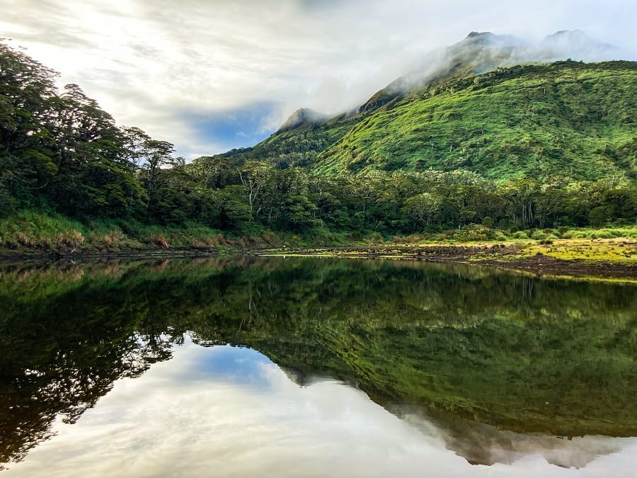
The hike up is over and the first part of the descent comes next. From the summit, you will be able to see an aerial view of Lake Venado down below. The trail goes through what they call the 'canal' which is similar to a water passage of the mountain. And since it is a water passage, we are advised that it is slippery whether it rains or not.


Downhill took us more than 3 hours until we reached the valley where Lake Venado is.

A stagnant lake sitting at 2,195 MASL, the valley is spacious enough to accommodate everyone's tents and camps. With its tranquil and still-like lake, unfortunately, swimming is strictly prohibited.
7) Hills between the Woods & Century Tree
Leaving the campsite at Lake Venado, you're down to the last day of the climb. The hike starts on the other side of the lake to enter the woods once more. Contrary to popular belief, it's not downhill all the way. There are downhill from each hill and in between will be small streams to cross and then uphill on the next hill. Some uphill is steep but short and there are approximately 3-4 sets of these.
A broad trunk of a tree I cannot forget, you will walk on it to cross a stream (3 feet below). No rope or branch to assist you, you can crawl if you want but it's manageable. If you have a fear of heights or vertigo, this can catch you off guard though.
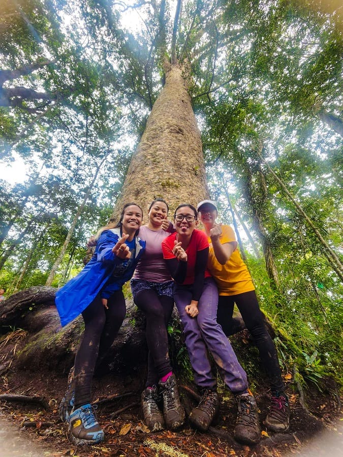
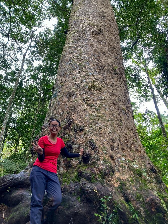
Still in the middle of the forest, the famous and humongous Century Tree is the pit stop for today to take lunch and photos (if you want).
8) Back to Sitio Tumpis and Sitio Culan
Now at the last part of the trail, it's a walk in the woods. It is generally flat with (more) muddy trails and mossy sections. A steep and slippery downhill awaits towards the end which the hikers call 'Punyeta Trail' (originally a Spanish word used by Filipinos to express frustration). A rope is fixed to help you, but the rope didn't help me either and I still slipped despite the absence of rain that day lol.
Coming out from the woods, the farmlands come into your sight once again, and shortly after are the humble homes of the villagers of Sitio Tumpis then back to Sitio Culan.
Hiking Arrangements & Contact Groups in Mount Apo (Santa Cruz Side):
Unfortunately, you are not allowed to hike on your own, a.k.a. the DIY style in Mount Apo. The Tourism Government requires you to arrange your hike with local operators for the permit, mountain guides, and even porters. This is for your safety and to prevent the worst-case scenarios from happening. On the other hand, it makes your climb a little easier in terms of logistics (transportation, meals, etc.) anyway.
You can contact the following organizers and/or mountain guides I met before and during the hike. Except for Vincent who I didn't get the chance to hike with, I had good interactions and memories with them and I can vouch for them (and their service) 100%. These links will take you to their Facebook account, so take it away!
- Mt. Apo Adventure Trip (my hike is arranged by this team - operated by Vincent Louise Alcontin, actual Mountain Guide Don Kulot, and moral /virtual support of Kim Alcala)
- Lakaw ni Paw
- Mountain Guide Jayson
- Mountain Guide Clyde Gingco
Rates of hiking arrangements vary though due to the differences in the services as well as your climb preferences (private/joining a group/etc.). Porters (who carry your stuff for you) can also be arranged by the local operators and mountain guides. The rate of porter as of January 2023 is Php75.00 per kilo per day.
Personal Thoughts:
As I always say, we all have different hiking appetites or what I call ‘#hikeppetite’ to begin with. So, a good trail for me might not be a good trail for you and vice versa. And that’s completely okay, we don’t need to agree with everyone all the time. Anyhow, here’s what I think about Mount Apo via Santa Cruz Trail:
Pros:
- For a major climb, this is a non-technical trail. There are short steep sections between Tinikaran Camp and Boulders Face plus the 87-degree section which makes the trail challenging. The rest of the trail is more like a trek in the forest which gives a balance to the challenging sections.
- Both Tinikaran Camp and the camp site at Lake Venado have basic toilet facilities and water sources.
- Except for the Boulders Section and the Summit, the rest of the trail has enough shade and you will not be exposed to the sun for so long.
Cons:
- It is a multi-day hike which means you have to carry your clothes and supplies good enough for the 3 days. Or you can pay for a porter to carry your stuff for you
- The hike comes with a price and you should expect to spend a minimum of Php 9,000 and above (including domestic flights).
- While it's a non-technical trail, no one should take it lightly (whether you're experienced or a beginner). The challenge of the multi-day hike will still require good physical fitness and endurance.
Compared to our multi-day hike here in the UAE called RAKTRAV 2020, climbing Mount Apo via the Santa Cruz Trail felt like just a walk in a muddy park. Of course, it is still challenging and beautiful in its own way but it wasn't challenging enough for my appetite. Nevertheless, the hike is memorable enough and I wanted to do the other trails, Kapatagan or a traverse maybe?

Whatever decision you make, always remember to prepare beforehand, stay safe, and last but not least, enjoy the outdoors! #happyhiking!
With lots of love,
PINAYHAKAWATI 💗
AND AS A GENTLE OUTDOOR ETHICS REMINDER:
LEAVE NO TRACE!


2 comments on “Mount Apo via Santa Cruz Circuit Trail (Philippines' highest mountain)”
So proud of you exploring mountains especially the mountains we own!
Thank you so much! I believe you're next! Can't wait to hear your travels in the future too!